N°10: First flight to the Hudson Bay Lowlands
On Monday, the 5th of September there was the first chance to do a research flight, named BELUGA, to the third largest wetland areas after the Amazon and Siberia wetlands, the Hudson Bay Lowlands.
Edmonton, 05.09.2022
You can see the flight track bellow
In such large areas with inaccessible terrain it is hard to collect data of wetland methane emissions from ground or with small research aircrafts, because of sheer size. As HALO is the acronym for High Altitude Long Range Research Aircraft, we had the unique possibility to cover a big part of the Lowlands within one flight.
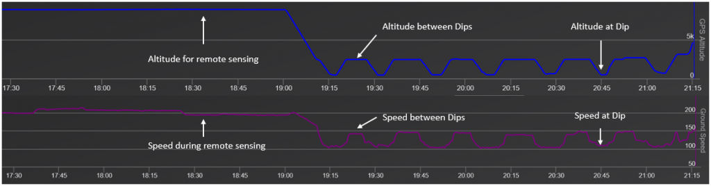
While flying in Remote Sensing altitude of approximately 9000m, HALOs velocity is around 720 km/h but of course the airplane is much slower at In-situ flight levels (few 100 meters above ground) in the Planetary Boundary layer, with a speed of less then 400 km/h. In order to also be able to sample large areas in the PBL, we decided to not just fly at the low altitude with low speed, but instead make so called Dips into the PBL. The idea was to safe time flying at 2500m and dive into the PBL only from time to time. This gave us about 25% more distance travelled during in-situ time. Bellow you can see the flight altitude vs. time, and the speed of HALO.
Check out the video below to get an idea of how low HALO flies during a dip
At the end we flew for more then ten hours and could therefore gather a lot of interesting data from a previously little studied area.
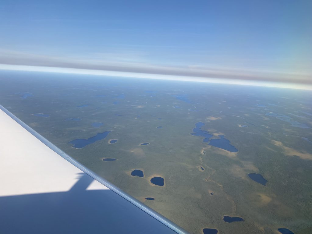
During the whole flight we saw a hazy layer of aerosol, which was probably caused by the active fires in the northwestern United States and the Canadian Rockies in British Columbia and Alberta. The plumes of these fires were transported towards the north east during the two days before, so their airborne particles could be seen over the Hudson Bay Lowlands. You can see that dirty layer in the picture.